Friday, July 12, 2019

The Collier Logging Museum

This week Diane and I went to the Collier Logging Museum.  Please click on the link to read about this wonderful outdoor collection of logging tools and equipment.  I'm going to focus on wheels in this short picture blog.


Interesting information about keeping things rolling.

Wooden wheels.


Not all wheels are on the ground, some are for steering.


And I could never resist a pretty face.


That's all for now.  


Monday, July 1, 2019

We Went Up Hurricane Ridge

Wikipedia says; "Hurricane Ridge is a mountainous area in Washington's Olympic National Park. Approximately 18 miles by road from Port Angeles, the ridge is open to hiking, skiing, and snowboarding and is one of the two most visited sites in the national park. At an elevation of 5,242 feet, Hurricane Ridge is a year-round destination." Wikipedia, if you'd like to read more about Hurricane Ridge click on the blue Wikipedia link.  

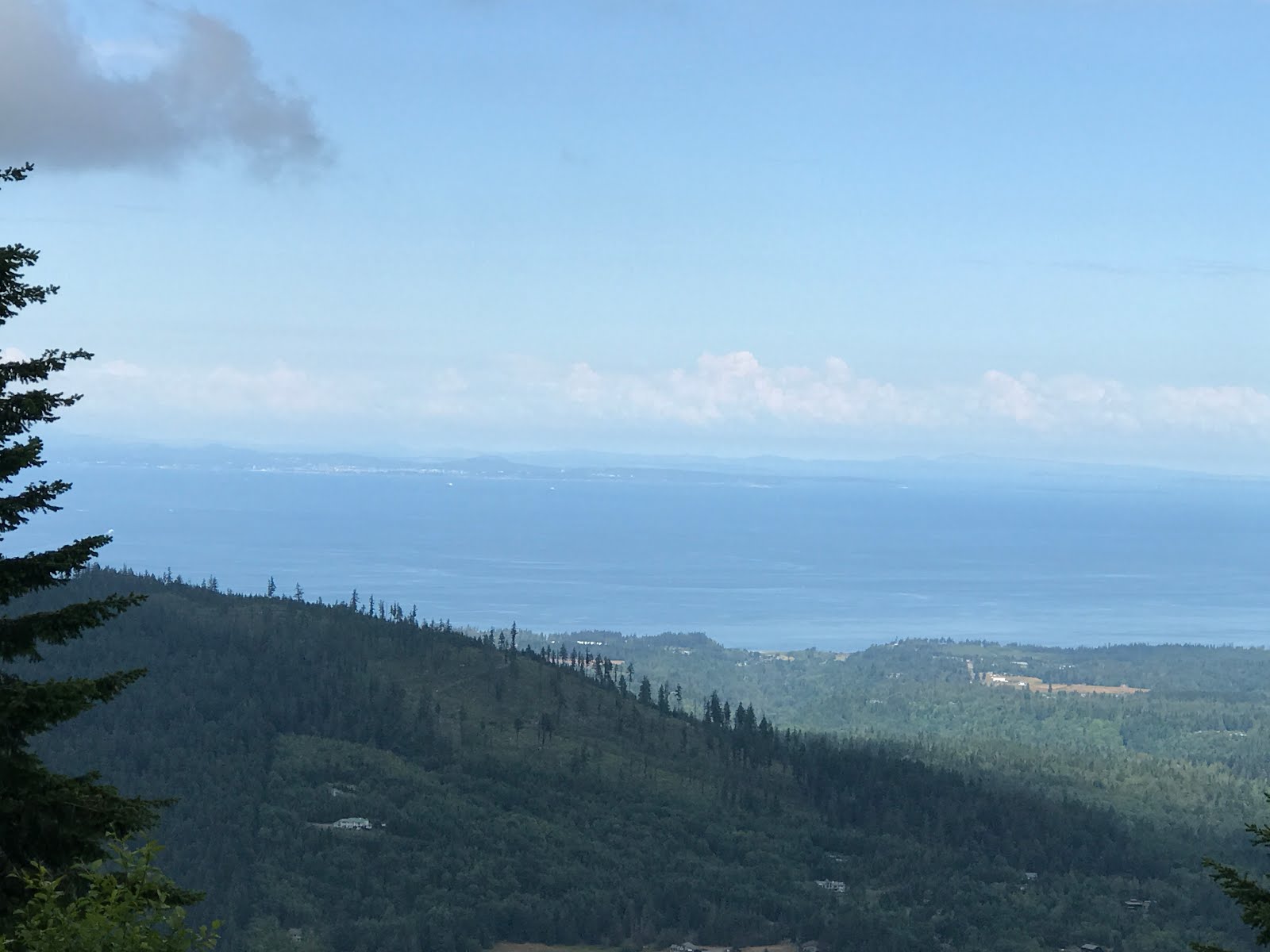
Looking east towards the Seattle area.

North towards Victoria Island, British Columbia, Canada.

Looking up to the top.

Topo map of the Olympic Peninsula.  
The Strait of Juan De Fuca are between the United States and Canada.
See the heavier dashed line there?  That's the border line.
See the lighter dashed line?  That's where the ferry 
runs between Port Angeles, Washington and Victoria Island, British Columbia.

See in the lower left, in the picture above, above the word Strait, there's a spit of land that juts out into the water?  That juts out from Dungeness County park where we stayed.  We also stayed in Salt Creek county park which is a bit west of Port Angeles.  

This marker was at Salt Creek park.  I'll tell you what is says.
TONGUE POINT REFERENCE MARK
Turning point 10 of the United States
and Canadian boundary between the 49th
parallel and the Pacific Ocean is 8358.5
meters N 13ยบ10'28"E of this monument.
(North American datum of 1927)

A very calm day.


Next morning not so calm.  That's a cargo ship.

The trail along the bluff.

Our camp site.

So along the theory that it's a small world,  I belong to a fair amount of facebook groups dealing with RVing and such things.  So on one of my walks around Salt Creek I saw a Born Free rv.  My friend Kyra has a Born Free and she belongs to a Born Free group.  I thought to myself that Kyra probably knows those people.  About 30 minutes later I'm scrolling through facebook and someone posts that they're in Salt Creek and I posted that I was too.  She said they were in the Born Free rv and to come over for a visit which I did.  

Here's Sharen by her Born Free rv, and yes, she knows Kyra.
We had a very nice visit.

The info about Hurricane Ridge at the beginning of this post was copied and pasted from Wikipedia, that's why it looks different.


Tuesday, June 25, 2019

Our Boat Trip Down and Up the Columbia River


I took this picture of our boat the day before our cruise,
 when the sun was shinning.


To learn about the Bridge of the Gods click here.


Entering the lock at Bonneville Dam.
  It's open and waiting for us.


Almost in.


In and secured.


It takes 12 minutes for the water to flow out of the lock.
Lower gates opening and the swing bridge is almost all the way back.


And away we go down river.


The water flowing from the lower concrete pipe is the lower end
 of the fish ladder on the Washington side. 
The sprinklers are to create camouflage for the fish.
Before the sprinklers were installed birds would hang around
and grab the fish as they came out the pipe.


Upper Multnomah Falls drops 542 feet down to the lower falls
which you can't see in this picture. 
To learn about the falls click here.

I'm adding two pictures of the falls that I took a few days before.


Here we are back in the lock, going up.  These are the upper gates.
When the lock is full of water the bottom of our boat will be
20 feet higher than the top of the solid part of the gate,
which won't move when the gates open.
We'll rise a total of 60 feet.


All most open.


If you look closely at the lower right corner of the blue roof on the left,
there's a red light.  We're waiting for the green light to exit the lock.

Ok, that wraps up our boat trip down and back up the Columbia River in Oregon.   After leaving that area we headed over towards theYakama Washington area spending several days without internet.  Now we're in the Port Angeles Washington area.  More about that in the next post.

Missie in our new front yard.


Tuesday, June 18, 2019

Bonneville Lock and Dam and Fish Ladder, Bonneville Oregon

Today is my birthday and Diane and I went to the Bonneville Dam and Fish ladder.  It was foggy in the morning but soon cleared up.  Some pictures were taken early and some later with clear skies.

Here's a Google map overview of the dam complex.


There are actually three dams, two are generating electricity 
and one is just holding back water.
You see the red Google flag?  That's Oregon's generating dam.

The Dam

Looking up stream from the Washington side of the Columbia River.  
Washington on the left Oregon on the right.

The dam on the Oregon side of the river.  
There are generators inside generating lots of electricity.

See, in the picture above, all the burned trees on the hills behind the dam?  This is the area of the Columbia River Gorge that burned in 2017.  Fire caused by teenage boys.  Read about that fire here.


The Lock

Looking down stream at the entrance to the lock.  
The roadway is on a 'swing bridge'.  
Which swings open for incoming boats and barges.
Taken through a window, sorry for the reflection.

The down river end of the lock.  Note water level in lock is up to match 
the water level on the uphill side of the dam.

Here's a short video about how locks work click here.
It's about the locks on the Mississippi River but they all work the same.

The Fish Ladder

This is an enlargement of the first map.
The fish ladder starts in the lower left area and is dark colored because of the water flowing through it.  Remember that all water on the left is down stream, meaning it's much lower than the water on the right of the dams.  The fish enter the ladder and work their way up to the middle of our picture, where the white water is.

The poor fish have a long way to go to get up and over the dam.

And up.  This is the white water area in the map.
See this top step?  Remember it as we'll come back here in a bit.

And up.
The fish are entering this area on the very far left, and swimming
their way through this maze.

If you look closely you can see this last bit of their ladder I call the maze.
They come through the white water area into a calm water pool, to catch their breath 
and through the maze and out into the water by the red band just above the word Google.
They are finally in the upper waters above the dam.

Ok, remember the top step in the whit water area?  We stood and took pictures of the fish as they were making their way over that step.  


A little tail splash.

More tail splash this time at the top.

They count the fish as they come up the ladder and past the counting window.

These are American shad.


We finished up our day at the Sturgeon fish hatchery.


Here is some information about sturgeon, from the U.S. Fish and Wildlife web site.

Sturgeons predate many fish species, appearing in the fossil record approximately 200 million years ago. There are 26 species of sturgeon and paddlefish in the Acipenseriformes group and many of these species are harvested as food. Living in a range of habitats, from subtropical to subarctic waters, sturgeons are found throughout North America, Europe, and Asia. They are bottom-feeders, eating small fish and invertebrates they find from sifting through silt or sand on the bottom of rivers and oceans. Some sturgeon species can grow to enormous sizes, reaching 12 feet in length.
Sturgeon and paddlefish are harvested for their meat and roe (fish eggs), which is then processed into caviar, a very expensive product for which there is a high demand.  Sturgeon roe now represents more than 90% of the commercial caviar market.
Click here to go to the web site for more info.

This was the small one and he came up to the window to see me.


Then I went outside to see him.  It's a bit hard to see him but let's give it a try.

Here he is swimming from left to right in the middle of the picture, he's grey.

Here he is coming straight to me and I almost missed him.

He was about 8 feet long.

From the sturgeon pond we headed over to the rainbow trout pond.  I know you're getting tired of fish pictures so I'll keep the trout pictures down to two.


Arn't they beautiful?

The hills are covered with wildflowers.


That's all for now.  Tomorrow is our boat trip up and down the river.  More about that later.

One last note, all pictures are taken with my iPhone 7+, with no editing.