I'm back at my friends horse ranch after being gone for a month while the RV was getting some work done. I might blog about that later, but for now there are more important things to talk about.
First off, the kitties and I are in a safe spot according to a fire person, who came by to look the situation over, because the horses and cows have eaten all the grass.
Here are some pictures of what's going on in California in general and Willits area specifically. Some of these pictures are taken from web sites, some from Facebook and some are mine. I'll make note of which is which.
This big boy flew right over the RV Monday evening
around 5pm. It made many drops of
fire retardant, which is colored red
so they can see it on the ground.
A 747 air tanker.
This is what the area around Willits is like and
some parts have even more trees.
Lighting strikes cause fires.
This is why we burn.
Not my picture.
At 12:16 pm Monday, Labor Day, a fire started,
not by lighting but by man, northwest of Willits.
This was taken from the horse ranch.
It's about 10 miles away as the crow flies.
This is the Oak Fire.
My picture.
Around sunset, 6:00 pm, Labor Day.
The Oak Fire.
My picture.
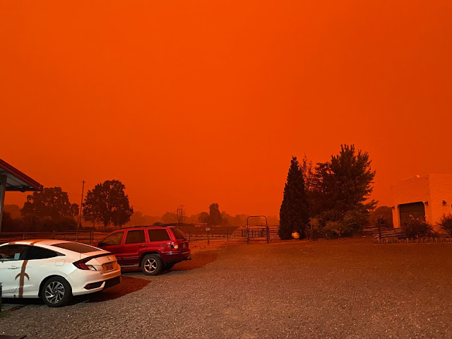
Tuesday, Sept. 8, 2020, at about 12 noon.
It's so dark that the barn lights have turned on.
We are now blanketed in smoke from the
fire in the Mendocino National Forest
to the east of us.
The August Lightning Strike Complex Fire.
My picture.
Around 1 pm it looked like this.
We felt like we were on the red planet, Mars.
Not my picture.
By 2 it was dark as midnight.
I went out to call the kitties in and needed a flashlight.
A picture of the Willits arch downtown.
Not my picture
This is a screenshot from my phone
showing the planes fighting The Oak Fire.
This app, FlightRadar24,
is free and it shows planes in the air
and when you touch a plane it shows
this info below and shows their flight path.
This is the CalFire spotter plane,
circling the fire telling the other
planes where to go.
At one time Monday afternoon
there were 9 planes and helicopters
fighting the Oak Fire.
A satellite picture of California.
All our smoke is coming from a fire
not labeled but
it's burning under the O
in the Oak Fire name.
The Lightning Complex Fire.
If I haven't completely bored you by now here are some web links with more info.
This first link is of a Fire and Smoke map. This is for the whole country.
This second one shows our county fires. You might need to zoom out, it loads the map a bit off.
If you zoom in on this second link, I'm at the southern end of zone 8, and our fire is moving north, away from town.
There's no end in sight for the fires to be out. The planes couldn't fly around Willits, for our fire, because of the smoke. I hope they were off fighting other fires. We're supposed to be getting high winds in a day or two and that won't help the fires, it might help with the smoke. But without winds the ground crews can get in there and work like mad, which they are doing.


